Free · no account · nothing stored
Bangladesh visited districts map
Bangladesh is divided into 64 districts here. Tick the ones you have been to on the map or in the list, see your count, then download the picture to share.
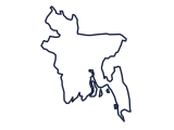
All 64 districts of Bangladesh
- Bagerhat
- Bandarban
- Barguna
- Barisal
- Bhola
- Bogra
- Brahamanbaria
- Chandpur
- Chittagong
- Chuadanga
- Comilla
- Cox's Bazar
- Dhaka
- Dinajpur
- Faridpur
- Feni
- Gaibandha
- Gazipur
- Gopalganj
- Habiganj
- Jamalpur
- Jessore
- Jhalokati
- Jhenaidah
- Joypurhat
- Khagrachhari
- Khulna
- Kishoreganj
- Kurigram
- Kushtia
- Lakshmipur
- Lalmonirhat
- Madaripur
- Magura
- Manikganj
- Maulvibazar
- Meherpur
- Munshiganj
- Mymensingh
- Naogaon
- Narail
- Narayanganj
- Narsingdi
- Natore
- Nawabganj
- Netrakona
- Nilphamari
- Noakhali
- Pabna
- Panchagarh
- Patuakhali
- Pirojpur
- Rajbari
- Rajshahi
- Rangamati
- Rangpur
- Satkhira
- Shariatpur
- Sherpur
- Sirajganj
- Sunamganj
- Sylhet
- Tangail
- Thakurgaon
Borders and place names are shown as provided by geoBoundaries (Bangladesh Bureau of Statistics, OCHA ROAP) (CC BY 3.0 IGO) and are not a statement by NextEuroTrip on any territory's status. Your map stays in your browser; we do not store it.